
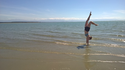
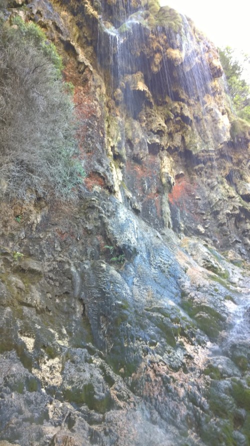
It was bittersweet saying goodbye to our friends. We had such a lovely time showing them around the country. We knew we’d soon miss the activities, dinners and comradery yet, the rapid pace was catching up with us and the too frequent dinners out were expanding our waistlines more than desired. As much as I love shopping, I didn’t want my increasing size to be the motivation for finding new clothes. So now it’s back to more careful menu planning, less dessert and wine and more hacky sack. We’d booked a roomy apartment in Arthur’s Point, a subdivision of Queenstown until the end of February in case Rick and Ruthie were able to extend their stay. The way it worked out, it was just the two of us in the apartment that looked over the Shotover River valley. We couldn’t actually see the river but we could hear the frequent jet boat traffic running up and down, often highlighted with the screams of delight from the passengers on the thrill ride. The place was perfect for everything we didn’t have planned for the next few days. We could just relax and soak in the sight of the rain and wind through the trees. We did spend some time re-evaluating the plans for the next few weeks as unfortunately my sister and her husband had to cancel their trip to New Zealand. We still have Stewart Island in our sights but we were unable to find accommodations on such short notice so we decided to follow through with most of the travel and accommodations already in place. The next four days provided some time for relaxing and recovering from being tour guides. From Arthur’s Point we headed west over Haast Pass to the west coast for a one night stay in Hokitika before driving on north to Nelson. We’d seen several weather alerts of heavy rain but mostly disregarded them. It wasn’t until we were driving through Mt. Aspiring National Park toward Haast Pass when we noticed many waterfalls cascading down the mountainsides that we both realized that the areas in the weather alerts for heavy rain lay along our route.
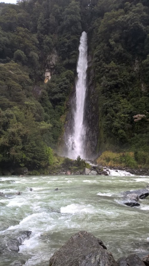
It seems that Haast Pass is known to be somewhat unstable when it comes to weather and there have been frequent slips (rockslides). Knowing this made me a bit uneasy as we embarked on our journey across just after the heavy rain. As we continued, we encountered some light rain. The waterfalls and scenery were enhanced by the recent weather. It was a lovely drive and fortunately “slip” free. Once we reached the coast the skies cleared considerably. The road followed along the rugged coast for a while before turning back inland around a large hill. Google maps indicated that our drive would be about six and a half hours. Just as we left Haast, Paul throws out a question “I wonder if I should have gotten gas in Haast? Did you see any other towns on our route up the coast?” I forced an exasperated sigh and shot back with “No, you should probably turn around” because I could imagine us running out of gas miles from any fuel station with no cell service and it was enough to considerably raise my anxiety level. He kept driving. I kept being nervous about running out of gas. The trip ended up being about seven hours because we made two stops, one at a lookout near Haast and then for fuel in Fox Glacier.

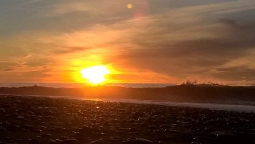
Yes, both stops were intentional, not because of an empty tank. For the one night in Hokitika we’d booked a hotel and just after we checked in we walked down the beach to have dinner after which we were treated to a wonderful sunset. Hokitika hosts an annual driftwood sculpture contest in January. The sculptures are left until the wind and sea come to reclaim them. We were lucky to see a few remained almost two months later. The sculptures are very impressive and unique and speaks to the creative talent of the local residents.
")
")
")
")
")
With another long drive ahead of us the next day and since Paul was on weekend break, we were able to get on the road relatively early. As we moved up the west coast we were enthralled at watching the clouds roll over the hills out toward the sea like a blanket being pulled by invisible hands.
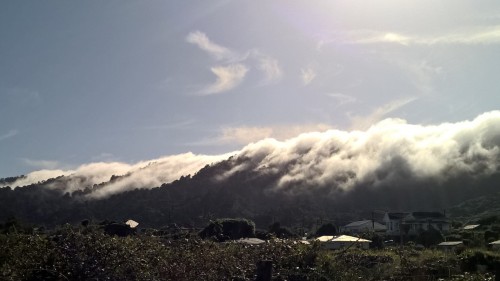
Clouds on hills in Greymouth
The clouds and mist hung over us, not as thick as fog but like a sheer veil all along the coast. It gave definition to all the layers of hills and valleys, a very different view than what we’ve seen up until now. Before we reached Westport we turned inland to drive through the Buller gorge. We’d been on this road before and happy to be seeing the gorgeous gorge again.
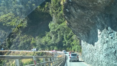
Driving the Buller Gorge
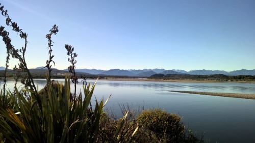
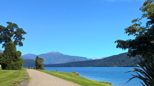
Nelson was our final destination for this day where we’d be staying for almost two weeks. We’d hoped to stay at the same place where we were last time, looking out over the Tasman Bay from high on the hill, but it was not available. The little apartment we found was wonderful though. It didn’t have much of a view but sat only about 1/2 mile from the beach. We walked that 1/2 mile many times during our stay. Tahunanui beach also offered a few miles of sand for walking, depending on the tide and playing hacky sack depending on the wind. We did have to cross over a little channel to get to the main beach. At low tide we could easily walk across, barely getting our feet wet but at high tide it would have been a difficult swim. The tide here changed by three to four meters (that’s around ten feet).
Tahunanui Beach at Low Tide

Photo from same location at high tide.
Walking the beach could have been enough entertainment for us but we also discovered a walking track around the perimeter of the airport which we could access easily. We walked out to the end of the airstrip for the thrill of watching the planes land directly over us and then jogged the whole track the next day. During most of our stay the weather was pleasant and sunny. We’re finally beginning to get a little color on our skin.
Fun at Tahunanui beach
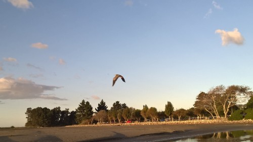
Beautiful bird at Tahunanui Beach.
Nelson is home to the Pic’s Peanut Butter factory so we toured that one day. It was fun to see where our favorite peanut butter comes from and meet Mr. Picot. We bought a bucket big enough to last us until we return to the States. Our friends from Blenheim came to Nelson one day and joined us for a sightseeing drive and lunch at a winery to celebrate her Birthday.
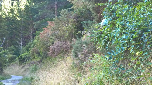
One weekend day we spent hanging out at the beach after taking Zed to get new shoes. With the tires already showing significant wear and with many miles or K’s ahead of us it was just one of those necessary purchases. Afterwards, we drove to the Eyebright Country Store and a berry farm where we indulged in some real fruit ice cream and “real” strawberries. The last time I recall eating such delicious strawberries was when my sister and I helped my Mom pick them from her garden. They were bursting with flavor and complimented our cashew pancakes perfectly the next morning before we drove up the Aniseed valley to walk the track to Whispering Falls. This turned out to be more of an adventure than we expected. I incorrectly assumed that the trail damage I’d read about on the internet would have been repaired by now. The beginning of the trail was a gravel road and we encountered one of the “spider nests” we’d been seeing in many places. Looking across fields there were all these little white cocoons on the tops of the grass with several stalks of grass woven into them. This one along the trail was on a shrub that was bending out over the edge of the trail and as we approached you could clearly see a black spot on the white webbing.
Spider web from a distance
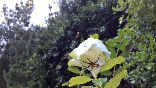
up close. Yikes!
WOW, when we got up close there was this huge black spider on the underside of the nest. I shivered with anxiety but stood around to take photos because even though spiders get me all jumpy, I find them truly fascinating. The trail followed a river up to the appropriately named Whispering Falls and in a few places it was very narrow along a little cliff falling away into the riverbed. At one point we came to a place where the trail ended at a slip, where the trail had fallen into the river. We had to wiggle our way down the slip to where we could pick up the trail again.
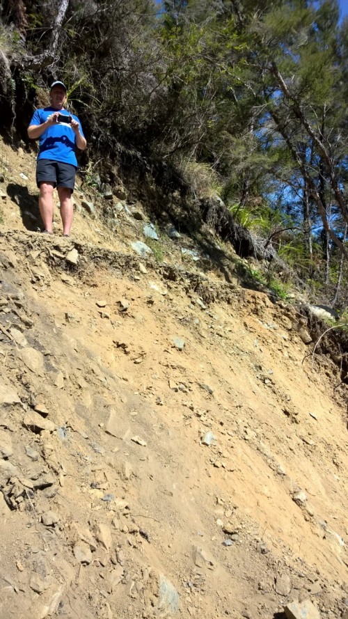
Paul at the slip on trail
Me, making my way down the slip to get to the next part of the trail.
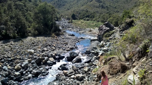
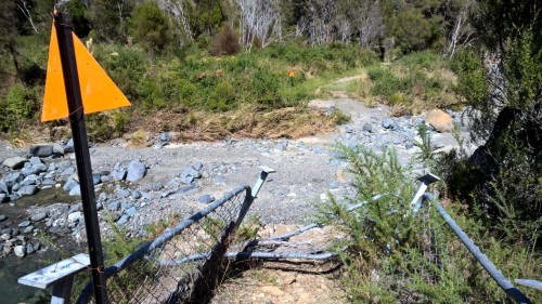
The internet description also indicated there were three bridges to cross. We crossed one and then encountered a second river crossing with some mangled wire fencing up on the opposite bank and large orange triangle warning on each side of the river. It was immediately clear this was where the second bridge used to be. Paul said it must be the “swung” bridge since we’d already crossed a swing bridge. The terrain was not sufficiently difficult to deter us, we hopped across the rocks. Well, Paul did; I hopped on a couple then splashed on a couple more. Then we scrambled up the rocks to reach the trail once again.
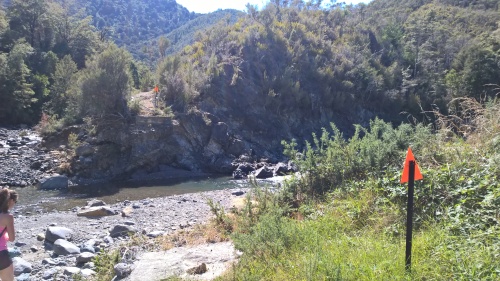
Two warning signs where the “swung” bridge was.
standing on the other side after crossing the river
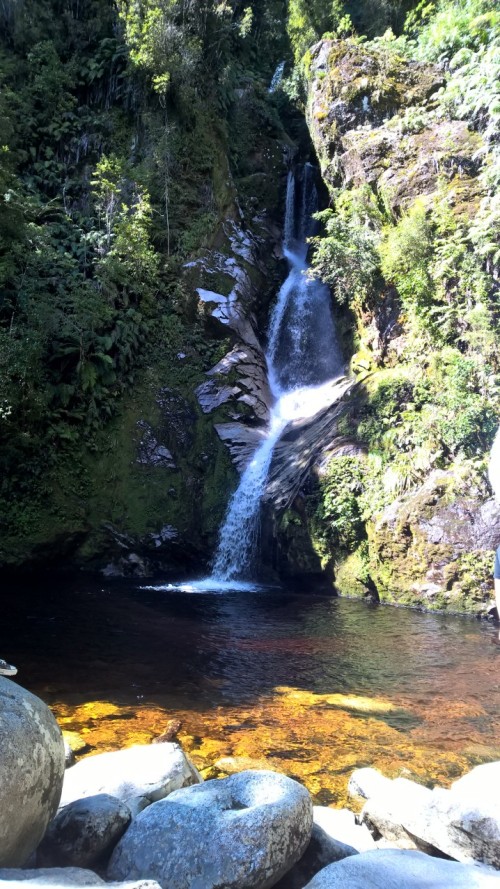
Shortly after crossing the third bridge, fortunately a swing bridge and not another “swung” bridge, we arrived at the Falls. Whispering Falls fell delicately in hundreds of trickling threads down the moss covered rock face.
Whispering Falls
It was such a unique little spot. We climbed the remaining few feet up to open grassy picnic area above the falls that looked out over the surrounding hills while enjoying our lunch.
The sun warmed us enough on the return trip that we went for a swim. Well, not really a swim, it was more of a dip. We couldn’t bear to stay in longer than a few seconds because it was frigid. It was certainly a refreshing and revitalizing stop.
After talking with our hosts here, we decided to make one more adjustment to our plans. Instead of driving back down the West coast to Franz Josef, only to drive back to Hokitika, we booked a place in Westport so we could go see the Kohaihai river. Our hosts could not stop talking about how this was an absolute must see. Now early in March, we drove back through the Buller gorge to Westport.
View from Ken & Mary’s in Westport
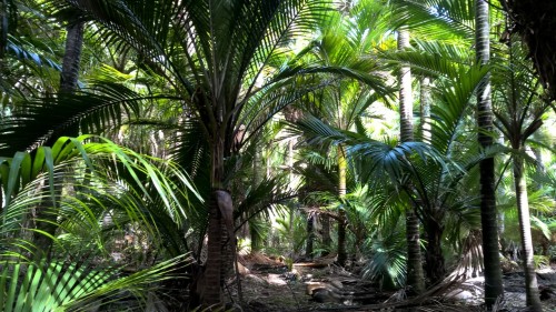
Here we met Ken and Mary, two of the most wonderful hosts. This was a short stay in Westport, only one weekend. The “must-see” stop was about an hour and a half drive north of Westport. We packed our lunch and set out for the Kohaihai river at the end of the road out of Karamea. This little spot is situated at the end of the Heaphy track, one of New Zealand’s “Great Walks” where the Kohaihai river enters the ocean. Nikau palm trees thrive in this little tropical sub-climate as do the sandflies.
At the start of the Heaphy Track
Among a grove of Nikau Palms
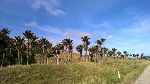
Nikau palms along road to Heaphy Track
We walked for an hour or so along the track to Scotts beach where we then strolled for a ways on the beach, watching the waves splash on the rocks. The trail was beautiful and there were a few spots with great views of the beach.
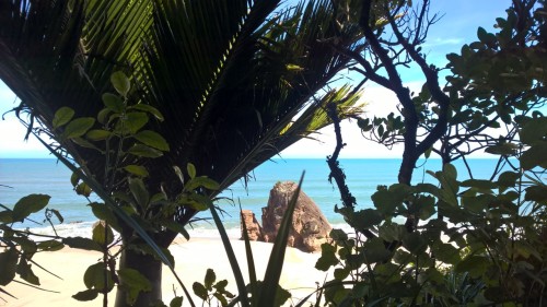
Scotts beach from Heaphy Track
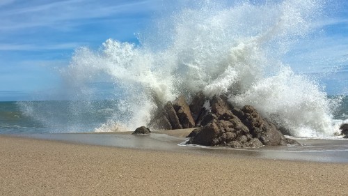
Dramatic waves at Scotts Beach

Me taking pictures of the waves at Scotts Beach
I found myself trying to imagine doing one of these “great walks” that take several days to complete. It would be fun, but would take considerable preparation and without reliable internet we’re out of luck for now. Perhaps another time we’ll get to tackle that adventure. On the drive back to Westport, we turned in and drove to the Denniston mine site. Ken, our host told us there were great views from there. We were expecting a little carpark at a lookout over the coast. Instead we found a large circuit of paths winding through a large historic coal mine site and village with boards explaining the history and the people who once lived in the lively community. We ended up staying much longer than anticipated, but were really glad we’d driven all the way up.
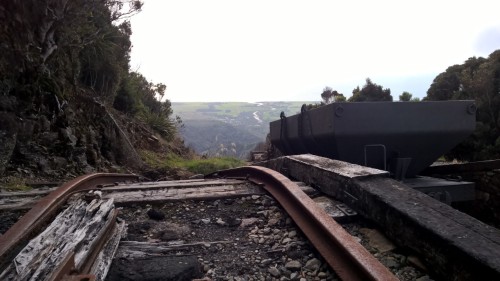
Denniston mine site at top of incline.

Looking down the valley at the top of the incline. You can see the track in the lower center portion of the picture.
That night Ken and Mary invited us to join them for evening tea (dinner). Mary made us whitebait fritters from some of the whitebait Ken caught last season. We’ve heard a lot about this hobby, whitebaiting, but Ken gave us even more details. We’d seen the rivers lined with campervans and people around September and October on our travels through the country and were told this is what they were doing. It is quite the pastime here. From the days of the first settlers, people have fished the rivers for these tiny white fish to enjoy and sell as a delicacy all over the country. We’d eaten it before in several places but this was extra special getting to share it with the fisherman himself. The next day we enjoyed a leisurely drive down the West Coast, taking a detour that Ken suggested and stopping at a couple of our favorite spots, Truman beach and Punakaiki. Then we stopped in Greymouth to pick up some bug spray from an Avon lady I’d found online. If there’s a necessity besides food here, it’s insect repellent. The sandflies are relentless and persistent.
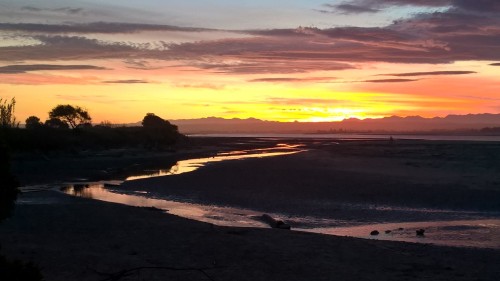
Once back in Hokitika, we found our new residence for the next five days. It was an old house next to the beach. The house was advertised as such and indicated that it was in need of work so we were not surprised to find just that. The appeal was the location which took precedence over luxury.
View to the East at Hokitika River.
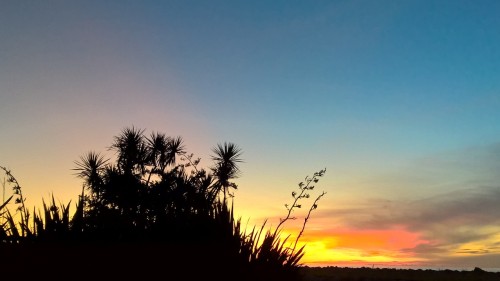
Sunset in Hokitika
The house was very spacious and had absolutely everything we needed for a comfortable stay, thankfully even wood for the wood burning stove when the temperature dipped to 44 degrees, apparently they don’t often see it get that cold this early. The cold only lasted one day, coupled with rain and we chose to visit the museum and store that day. Most of the other days we were out at the beach or walking along the river. The beach here has such a different feel than those near Nelson or on the east coast. It is obvious why this is referred to as the wild west coast. The waves come rolling in with dramatic crashes and pull out with a roar as the stones tumble in the aftermath.
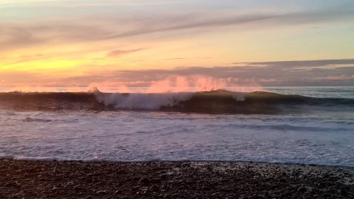
Hokitika beach
We could hear the soothing dull rumble just sitting in the house. The old place sure had a unique feel and some funny noises. We kept hearing something that neither of us could identify. We speculated on the source. Imagining an angry cat hissing or a seal or other sea creature trapped under the house. Finally, after a couple days we discovered it was the air freshener squirting smelly stuff into the entry. For the remainder of our stay, we’d giggle every time we heard it imagining an old guy sneezing down the hall. A visit to Hokitika gorge was on our to-do list and we kept watch on the forecast trying to find a sunny day for this outing. There was one, and luckily the forecast was correct. That Thursday morning the mountains sitting east of the town were crystal clear and you could even see Mt. Cook to the south.
Mt Cook on the horizon. View from Hokitika
We drove to the gorge and took the short walk across the swing bridge over the brilliant turquoise water.

View of swing bridge over Hokitika gorge.

Hokitika gorge
From here we followed the road in a loop around Lake Kaniere with a stop at Dorothy Falls and Canoe Cove.
Dorothy Falls
Lake Kaniere
Along the walk through the Rimu forest down to Canoe Cove I was captivated by several plants I haven’t seen before.
")

")
")
")
")
")
")
We reveled in having the trail all to ourselves. The remaining days in Hokitika were cloudy, but that did not quiet the ocean and we still found ourselves walking the beach under gray skies.


")
")
")
")
")
")
")
")
")
")
")
")
")
")
")
")
")
")
")
")
")
")
")
")
")
")
")
")
")
")
")
")
")
")
")
")
")
")
")

")
")
")
")
")
")
")
")
")
")


")


")
")
")


")
")
")

")
")
")
")
")
")
")
")
")

")
")
")
")
")
")
")
")
")


")
")
")
")
")
")
")
")
")
")
")
")
")
")
")
")
")
")
")
")
")
")
")
")
")
")
")
")
")
")
")
")
")
")
")
")
")
")
")
")
")
")
")
")
")
")
")
")
")
")
")
")
")


")
")
")
")
")
")
")


")


")

")
")

")
")

")
")

")
")
")
")
")
")
")
")
")
")
")
")
")
")
")
")
")
")
")
")
")
")
")
")
")
")
")
")
")

")
")
")
")


")
")

")
")
")
")
")
")
")
")
")
")
")
")


")
")

")
")
")
")
")
")
")
")
")


")
")
")


")
")
")
")
")

")


")
")
")


")

")
")
")
")
")
")
")
")
")

")
")


")

")
")
")
")
")
")
")
")
")
")
")

")
")
")
")
")
")
")

")

")
")
")
")
")
")
")
")
")
")
")
")


")
")
")
")
")
")
")
")
")
")
")
")
")
")
")
")
")
")
")
")
")
")
")
")
")
")
")
")
")
")
")
")
")
")
")
")
")


")
")
")
")
")
")
")
")
")
")
")
")
")
")
")
")
")
")
")
")
")
")
")
")
")
")
")

")
")
")
")
")
")
")
")
")
")
")
")
")
")
")


")

")
")
")
")
")
")
")
")
")
")
")

")
")
")
")
")
")
")
")
")
")
")
")
")
")
")
")
")
")
")


")
")
")
")
")
")
")
")
")
")
")
")
")
")
")
")
")
")
")
")
")
")
")
")
")
")
")
")
")
")
")
")
")
")
")
")
")
")
")
")
")
")
")
")
")
")
")
")
")
")
")
")
")
")
")
")
")
")
")
")
")
")
")
")
")
")
")
")
")
")
")
")


")
")
")
")
")
")
")
")
")
")
")
")
")
")
")
")
")

")
")
")
")
")
")
")
")
")
")
")
")
")
")
")
")
")
")
")
")
")
")
")
")
")
")
")
")
")
")
")
")
")
")
")

")
")
")
")
")
")
")
")
")
")
")
")
")
")
")
")
")
")
")
")
")
")
")
")
")
")
")
")
")
")
")
")
")
")
")
")
")
")
")

")
")
")
")
")
")
")
")
")
")
")
")
")
")
")
")
")
")
")
")
")
")
")
")
")
")
")
")
")
")
")
")
")
")
")
")
")
")
")
")
")
")
")
")
")
")
")
")
")
")
")
")
")
")
")
")
")
")
")
")
")
")
")
")
")
")
")
")
")
")

")
")
")
")
")

")
")
")
")
")
")
")
")
")
")
")
")
")
")
")
")
")
")
")
")

")
")
")
")
")
")
")
")
")
")
")
")
")

")
")
")

")
")
")
")
")

")
")
")
")
")
")
")
")
")
")
")
")
")
")
")
")
")
")
")
")
")
")
")
")
")
")
")

")


")
")
")
")
")


")

")
")

")


")


")


")
")
")
")


")


")
")
")
")
")
")


")


")
